CHERISH project Landscape Photogrammetry
Photogrammetry | 3D Modeling
| Photogrammetric processing
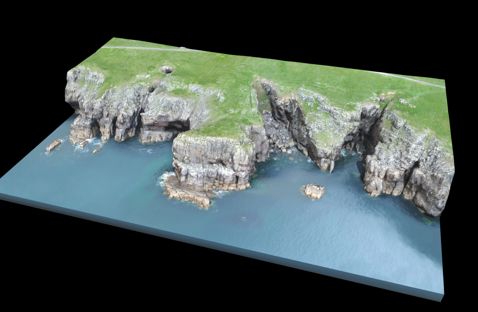
The RCAHMW CHERISH project sought to provide an interactive way for audiences to better understand some of the historically important landscapes along the coastline in Wales. Having carried out drone photography at four locations, they were then seeking to have photogrammetry models created and processed for uploading on to their page of the 3D model publishing site Sketchfab.
Challenge
Photogrammetry, and especially drone photogrammetry which collects vast amounts of data, creates huge point clouds. We were tasked to take the point clouds the RCAHMW had created, process them into models, and reduce their size so that they could be uploaded on to Sketchfab while keeping them looking high quality.
Royal Commission on the Ancient and Historical Monuments of Wales (RCAHMW)
CHERISH Project
The RCAHMW landscape 3D models provide an engaging way for audiences to better understand these historic landscapes through online interaction..
Innovation
Photogrammetry of landscapes and the resulting 3D models are a relatively new solution to help audiences better understand and visualise an area that otherwise might only be viewed in whole by air.

“It was a pleasure to work with Experience Heritage. Communication throughout the process was just brilliant and the final products were exactly what we were looking for.”
- Dan Hunt, RCAHMW

